So you wake up at Cannibal Cove campsite and take a tramp (walk) along Dead Horse Road to Misery Hut. After a quick lunch, make your way to the summitt of Mount Hopeless.On the way cross over the bridge at Dead Man's Creek, cross Butcher's Flat and spend the night at Cowshed Bay.
Maori names are far more poetic and fit the landscape superbly, even if you can't pronounce them. The poineers had a lot of new places to name when they arrived - looks like they became exhausted witht the creative effort!
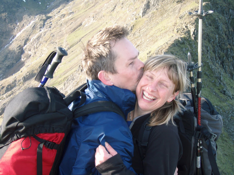
Liz
Matched
Crib Goch NY Eve 2008
Tuesday 26 April 2011
Friday 15 April 2011
Kayaking the Abel Tasman Tramp


Bit of a downer on tramping at this point, we headed north to kayak on the Abel Tasman route. We both had been really excited about doing this - and we were right to be!
A freedom rental for three days, we persuaded them to give us a kayak each instead of a double, which would only lead to domestic strife. We were given a full briefing by the staff and supplied with safety equipment (pump, flare) and a map of the coast line. We packed our tent, food and spare, dry clothes on the hatches. Yippee. - Expeditioning in a boat. The forecast looked good, but we were told to expect it to be a bit choppy in a section called the "Mad Mile". Launching at Marahau we headed northwards to camp at Mosquito Bay. So far so good, we lunched on a sandy beach and then headed for the Mad Mile. Choppy! Flippin swell of 2-3 metres. Bigger than anything I'd ever paddled in before. We decided to turn around (a problem in itself as you don't want to get caught side on)and go back to safer waters for a think. A conversation then followed with a guy who had just emerged out of the Mad Mile. We asked how long the section of swell lasted, did it get worse etc. He said, you seem aware of the situation by your questions, if you have the stamina to do it go for it. So we did. 50 minutes later we emerged at Anchorage Bay, exhausted and drained. We were not "paddling fit" and we simply knackered. I can still remember feeling totally s**t scared sitting in my little boat at the bottom of those troughs with a three metre wall of water above me. We found out later that the forecast had been changed at midday and that that swell was the worst that section only rarely ever got. Shame it was the day we visited.
Not to be put off we had a good night's sleep and set off north towards yesterday's destination. The sea was as flat as pancake all day and the sun shone. Beautiful and totally chilled out. Still both tired we decided to go back to Anchorage for the night and then paddle back to our launch pint on day three. The Mad Mile could well have been on another planet on our return and we were amazed at how quickly we paddled through that section. So, would we do it again. Ask Greg!
(The pictures on Picasa are from the times when the sea was calm as 1. the new camera is not waterproof and 2. if it gets a bit rocky you need 2 hands to steady yourself).
No of nights camping = 29
www.picasaweb.google.com/lizzypatkay
Wanaka


Wanaka is the location location "des res" area of NZ if you like your outdoor sports. It's bigger neighbour, Queenstown is full of bungy jumping and other packaged excitement, but Wanaka is a place one (ie me, Liz) could live in.
In our 6 days in the area we managed to fit in our first tramp of the trip (that's hiking in Brit speak), mountain biking and some climbing. If we here over winter this would include snow sports too. Since this was Greg's third visit to NZ, I took the steer from him, so when checking out the local tramps, we saw that there was a DOC mountain hut called the Liverpool Hut perched at the bottom of Mount Liverpool itself. Not much choice really it had to be done. However, when checking out how to climb the peak, we realised that it was a full on mountaineering route and our ice axes and crampons are at home in the UK, so a tramp to the hut we did and gazed out at the glaciers above saying what we would do if we manage to come back. The hut was in the Mount Aspiring National Park, and to be honest it was not what I expected. Most tramps at a low level follow valleys which are heavy vegetated (the bush). The path follows slippy tree route strewn tracks with equally slimy slabs of schist rock - yuk. The sections where it opened out for a view were brilliant, but we spent a lot of time just looking at tree trunks. Were we spoilt in Nepal?
The huts, however, are a dream. Clean (compared to European Alps), well organised and all supplied with loo paper! We even got discounts in NZ Alpine Club huts with our BMC membership cards - hurrah!
The wildlife is also entertaining for this is the domain of the Kea. Kea really are the naughty boys of the bird world. Big dark green mountain parrots. They gang up near huts and campsites in the twilight of evening and mornings, swooping down low and squawking a shrill shriek like sound to each (like calling "they're over here"). All very Alfred Hitchock. I actually found them quite scary. In the Aspiring Hut, the warden was telling us stories on how they had robbed people's boots left outside, and then they bring stuff back a few days later. The warden had left a mirror out for them to play with. They took it away and then returned it a week later. On the morning we stayed, we woke to the sounds of them tapping at the roof and entrance door of the hut (like they were trying to get us). I saw them having a fight over a pair of slipper liners that had been left out, and someone else told us a story about a mate who had been bivying out who had had his nose pecked at by them. Explain that one in A&E.
The DOC seems to be something of an institution in NZ. Their level of signage is very conscientious and informative (2 people only at a time on this bridge or do not attempt this tramp unless you are an experienced tramper). It contrasted greatly to the no signage above the huts. This is where you are on your own and true mountaineering skill come into the fore. Someone explained that they have to do this as there had been a well known accident a few years previously with a lookout platform full of school kids collapsing. Hard way to learn.
Further north up the west coast, we went up to the Welcome Hut so we could have free and hard earned soak in a hot spring. More bloody trees, but worth it for the rewarding soak in the evening on our own surrounded by snow capped peaks. Pity about the sandflies!
No of nights camping = 21
Pics show Liz in the hot springs outside the Welcome Hut, Greg climbing at Hospital Flats, Wanaka, view of Mount Aspiring from the Liverpool Hut, outside the hut and a section of the awful slippy path up to get there.
Fiordland


Greg says that the Maoris have a legend that the Gods put sandflies in Fiordland to stop people living there as it is so beautiful. You're not kidding!
Check out the map as there aren't any roads into this area, except for the one up to Milford Sound. I think it would be much more exciting to access by the sea in a kayak, but that will have to wait for another trip.
Beautiful DOC camping spot on the road to Milford Sound at Henry's Creek on Lake Te Anau. We checked out the sound and envied the folks going on scenic cruises, which were a bit beyond our pocket, meaning we wouldn't be able to eat for at least a week after our trip! Unfortunately, the only kayaking on the sound was a guided trip and there was no freedom rental (on your own) available. Went for a bush walk to Misery Creek (as you do) and ate loads of food.
Total no of nights camping = 14
Pics show views of Lake Te Anau, Mitre Peak across Milford Sound, a cute little bird that followed us on our walk and parked up before entering the Homer Tunnel.
Thursday 14 April 2011
Convelesing in the Catlins (and Invercargill)


So south we go, heading for an area of wild sea-scapes and rolling hills. The Catlins was named after a sea captain who, apparently, bought the land from local Maoris. In the end he never got round to visiting the place, but they still named it after him. Pity - his loss!
The plant life and wildlife are starting to individualise themselves to NZ now. Loads of wiggly trees they call cabbage trees, and pod carp forest, which I (Liz) think are tree ferns. There is a notable lack of indigenous mammals. Plenty of imported sheep, cows and antler-less red deer, but nothing big that originated locally. However, they make up for this with birds, and the morning chorus is impressive to say the least. The little birds are so tame as well, coming in really close to you. When we were in the Catlins at Curio Bay we saw five yellow-eyed penguins, which you should be impressed by as this is the rarest penguin species on the planet! (Needless to say neither of us had even heard of them before arriving here).Highpoints were camping in Department of Conservation (DOC) campsites. The DOC have little camping spots in some of the most beautiful and isolated areas. They only provide at a minimum, a loo and a water supply. Paying is an honesty box and there is usually only room for about 6-10 tents. However, it does mean that you can pitch your tent right next to a beautiful lake,or right by the sea. This would all be brilliant and perfect if it wasn't for the sandflies. These are the midgies of South Island, and they don't seem to mind the sun, breezes or anything - boy do their bites itch.Oh the illicit pleasure of scratching.
From the Catlins we moved on south to Invercargill and stopped at Sandfly Bay for a few days of comfort camping on a good site. Sunshine, more eating and Greg's ear is ready to play out again. So back on the road-trip.
Total no of nights camping 10.
Pictures show 1. black tree fern canopy 2. Petrified Forest at Curio Bay 3 and 4 Strange rock formations Purakaunui Bay 5. Nugget Head Lighthouse
East coast road trip

Half a day's drive from Christchurch and we land on the Otago Peninsular just outside of Dunedin. They call Dunedin a city, but it's more of a market town UK stylee. Driving is a breeze, simple two lane roads, no hold ups and the occasional overtaking lane. Greg explains this is down to the much lower population density.
There's something about the light here. I'm not sure if it's to do with the extra UV (40% extra I'm told). The sky seems huge and quite dominating, the light is really bright and the edges of shadows are sharp and well defined. It reminds us of places such as St Ives or Pembroke, so maybe it's something to do with reflected (or refracted) light from the sea - an abundance of a certain wavelength or something. Anyhow, speculate as you do, it's quite amazing, and I do actually think some of the photos have captured this to some extent.
Otago is brimming with wildlife. In our three days we saw albatross, blue eyed penguin (smallest species) and NZ fur seal. We actually nearly tripped over the seal who was just plonked on the beach next to where we were sitting. We were there for about 20 minutes before Greg saw it about three metres away!
The weather was great and then bad, then great again. This seems to be a pattern here. Sure, we've had some really wet days, but they only seem to last for a short period before the sun comes out again and you can dry your tent and washing. Not quite as depressing as those gray overcast weeks on end we are used to at home.
Greg's ear still causing problems and we both feel like a bit of a rest from more adventurous activities. We are both enjoying our food really eating for England to make up for the past 6 months. So, we decide to head on south with our new tent and spend a few days in the Catlins.
Land of the Long White Cloud


So we landed in Christchurch three weeks after the quake. We tried to get diverted to Auckland as a gesture of good intention, but the airline wanted to charge us an additional 90 pounds each airport tax. Imagine how many weeks accommodation that adds up to!
It was a funny feeling arriving in a community that was definitely in a group "post traumatic" situation and I (Liz) really felt sorry for the city and it's people. We stayed at a backpackers right on the edge of the sealed off area with collapsed buildings surrounding us on all sides. The older, stone buildings had been hit the most as they can't flex. This meant lots of collapsed churches. Evidently, all buildings had been inspected within the first 48 hours and given a green (habitable) or red (condemn) sign. You could see what a really livable city it is as well. Big parks with mature trees, a little brook running through the city centre (sans shopping trolley, big wide roads, great cafe scene - just lovely really.
The earthquake itself was not that high on the Richter scale, but the destruction had been caused because the epicentre was directly under the city centre and not very deep down, 5Km I believe. There were also after shocks on varying magnitude. A 4.5 tremor scared the life out of us after our dinner on the first evening. It lasted about 6 seconds. Then two more in the night waking me up with my top bunk swaying thinking the ceiling would crash in on us (Greg slept through this). The folks in the hostel talked of everything rumbling and the contents of shelves crashing around them. They ran out into the garden, but couldn't keep their balance because of the movement! I couldn't help thinking that surely each quake weakens a building's structure and there were indeed cracks in the walls.
All around town we saw piles of a gray powder type substance. I thought everyone was planning extensions and that it was builder's cement - wrong. This stuff was also a product of the quake and was called liquefaction. Neither of us had heard of this before, so dear readers if anyone could shed some light on what this stuff is and how it relates to plate tectonics we would be very interested - thanks. Apparently it just oozes out of the earthquake cracks in the ground as a type of gray sludge. I comes out of the vents under houses, gutters and grids. The piles were where people had brushed it up ready for bagging away.
The people of Christchurch are real corkers. We were impressed and touched by how the community had pulled together and the whole place had a real buzz of activity as the big clear up was actioned. There were also government TV adds about everyone else in NZ thinking of Christchurch and that everyone should be talking to neighbours, checking everyone is OK and just finding someone to talk to. Quite touching stuff really and perceptive of the government as they obviously wanted to reduce poor mental health problems and community morale.
We set about trying to get Greg better (pain in ear) and to buy a car. I was very happy three days later to leave as we had bought our new motor (all 900 $NZ - about 450 quid)and were about to start our big NZ road trip.
It would be great to see Christchurch back on its feet again and to walk down it's high streets visiting all the nice restaurants and shops :(
Liz
Postscript July 2011: Liquefaction is created when ground water becomes under pressure due to tetonic shifts. It occurs in clay soils. The pressure created by the earth movement mixes the water and silt from the clay together. Under pressure, this mixture needs to escape through openings/cracks in the earth's surface. This gray sludge can cause a lot of damage. So there you go!
Subscribe to:
Posts (Atom)